The dull grey clouds were hanging low in the sky when I set off from the Whakapapa Village carpark at 11:30am. Somewhat embarrassingly, I was already breathing heavily when I got to the start of the track.
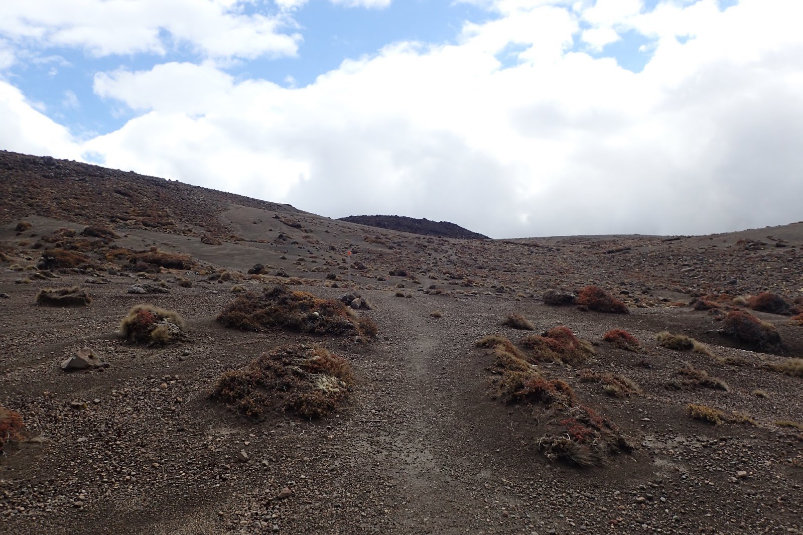
Luckily for me, the track is top notch - even, well-graded and well maintained. The track meanders through the tussock and scrub, on a clear day the open landscape would provide great views of the mountains, but even in the gloom it was still a sight to behold.
It was a fairly short 45 minutes to the Taranaki Falls junction.


Once back at the junction, the well-marked track continues through the windswept landscape, slowly climbing toward Tama Saddle.


7.2km/2hr 10 min from the start, I reached the signposted junction for Tama Lakes, a pair of old craters now filled with water. I only went as far as the Lower Tama viewpoint, which was a great place to sit and eat for a few minutes.

 |
| Tama Saddle |

 |
| Waihohonu Valley from Tama Saddle |

Eventually, the track meets the Waihohonu Stream. From then on, the track is never far from the stream as Waihohonu Hut draws closer. I was slowing down at this point, not used to covering this kind of distance in a day. It was also about now that the rain, which had been coming and going all day, now began to properly set in.


16.8km from the start, and not far from the hut, a signposted junction gives direction to the original Waihohonu Hut, built in 1903.

I reached the hut after 5hr 50mins (17.7km).

 |
| "Welcome to the Chateau Waihohonu" - Sam, DOC Ranger |
Day 1 GPS data:
Total distance: 17.7km. Total time: 5 hr, 47 min. Overall average speed: 3.1km/h.
Map:

There was plenty of cloud still hanging around as I hobbled around the hut, getting breakfast and packing up my gear. Thankfully the forecast was looking alright, and the tramp to Oturere much shorter than the previous day. With the weather currently holding out, and my pack ready to go, I decided to head out early, leaving the hut at around 8:15am.
From the hut, the track almost immediately enters beech forest reminiscent of parts of the Tararuas and drops down to a footbridge over the Waihohonu stream, then passing the camping site before beginning to climb up a ridge.


 |
| Section of track could easily be anywhere in the Tararuas |


Once the ascent is over and done with, the track follows a fairly direct path to Oturere.


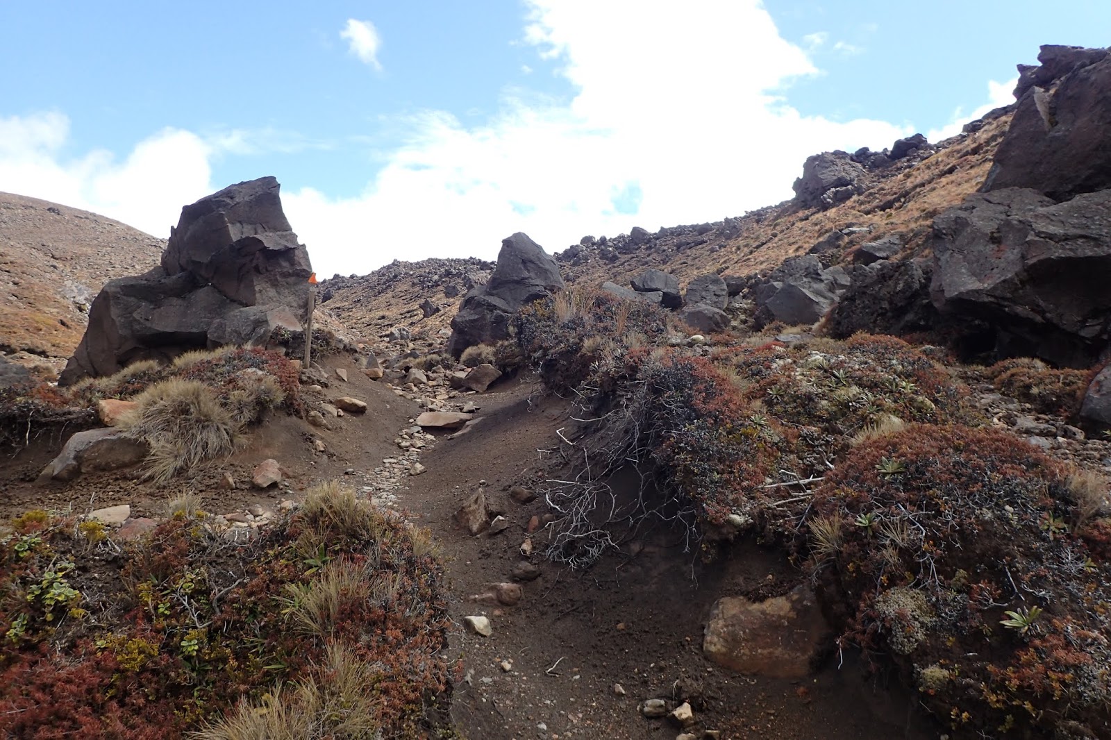
Not far from the hut, a jagged and rocky land form (an old lava flow) makes a stark contrast to the relatively smooth slopes the track has crossed until the point. The track climbs steeply onto this old lava flow, and the hut is reached just under 1km later.


Total distance: 8.1 km. Total time: 3 hr, 44 min. Overall average speed: 2.16 km/h.
Map:

After having plenty of time to rest up at Oturere, I felt quite refreshed as I departed. That, and the good forecast weather, had me in high spirits as I walked up the otherworldly Oturere Valley.
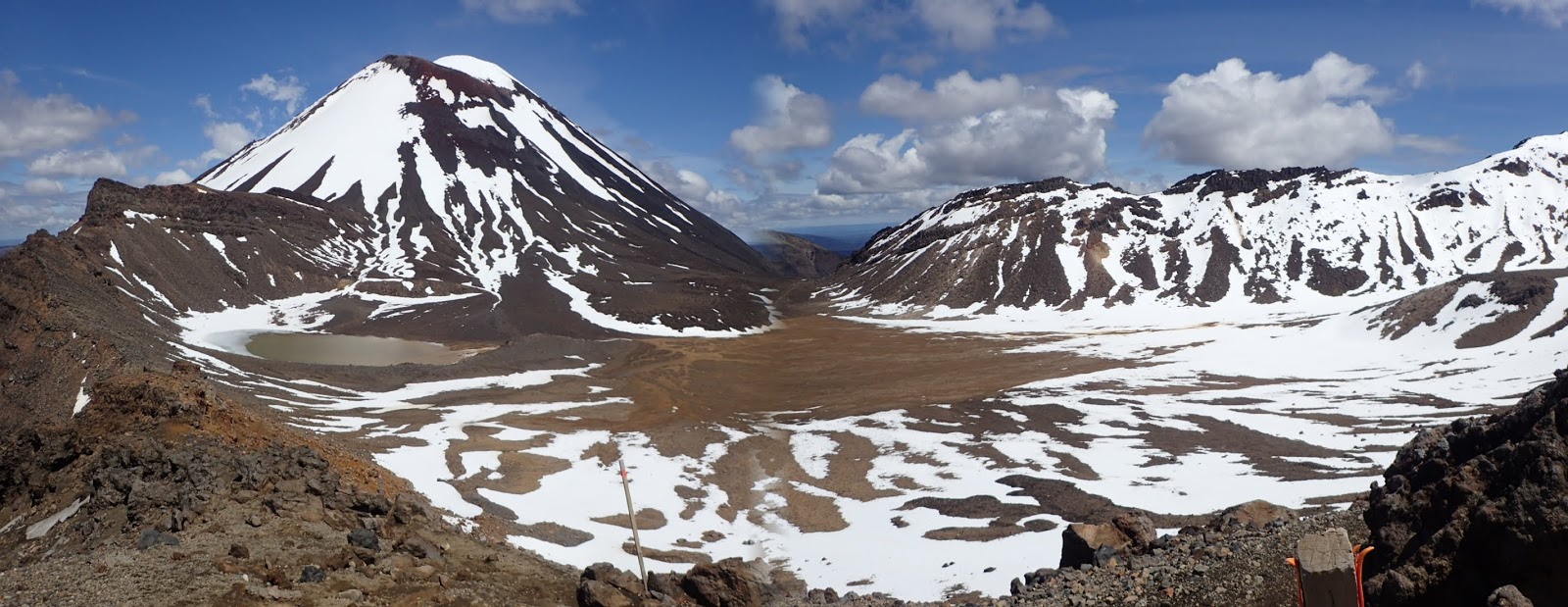
It's difficult to describe this place, because there isn't really anything to compare it to. Bizarre rock formations surround the track; lumpy, jagged boulders litter the ground; the landscape is barren and alien - the result of ancient lava flows. It's a surreal place, and the mostly pretty flat gradient makes it all the more easy to enjoy. It's a landscape that could just as easily look at home in Doctor Who or Star Trek as it would in Lord of the Rings.


As I got closer to the top, the ant-like forms of walkers on the Tongariro Apline Crossing became visible.


I decided to take a brief sojourn through the snow to blue lake.


Once again: absolutely beautiful and defies description.


By this time, it had been 3hr50/6.77km since Oturere Hut, but I was far too lost in the views to notice how long I'd been walking.
From red crater, the track descends steeply over rocky terrain down to South Crater-that-technically-isn't-a-crater, the near perfect cone of Ngauruhoe looms constantly.


Near the top of the valley, the soda springs waterfall is worth checking out. From there it was a fairly straightforward walk to Mangatepopo hut. Although by this point I had begun to notice the aches and pains seeping back into my legs.


Mangatepopo hut can be seen long before it is reached, and lies a short distance off the main track.


Needless to say I very much enjoyed a lie-down and hot meal before getting a good nights sleep.
Mangatepopo was a comfortable hut with two bunkrooms off opposite sides of the communal cooking/dining area and a bit more space than Oturere. Like the others, the hut has solar lighting and gas cooking, but gas heating rather than a woodfire. The tussocky Mangatepopo valley and Ngauruhoe are visible from the large front decking.
Day 3 GPS data:
Total distance: 13.8 km. Total time: 6 hr, 47 min. Overall average speed: 2.03 km/h.
Map:

Day 4 - Mangatepopo Hut to Whakapapa Village
Low cloud and misty rain greeted me when I woke up. Someone had fired up the gas heater so the hut was nice and warm though.
Layered up warm and dry, I headed out on what would hopefully be a short tramp back to Whakapapa Village. I had read that the track was in bad shape, heavily eroded and such, but it's really not as bad as all that. Sure, it's not up to the same Great Walk standard as the rest of the circuit, but it's otherwise just a fairly standard tramping track.
The track is indeed quite eroded and rutted in places, particularly badly in a few places, which can be annoying - but nothing to ruin your day.


Day 4 GPS data
Total distance: 9.31 km. Total time: 3 hr, 3 min. Overall average speed: 3.04 km/h.
Map:

Without doubt, this was the single most spectacular tramp I've ever done. Not to denigrate the humble Tararuas, but there's something so unique and incomparable about crossing through and over an active volcanic landscape. Equal parts dramatic, awe-inspiring, rugged and beautiful, there's very good reasons why the Tongariro National Park is as popular as it is. A Great Walk indeed.
Total Distance: 48.9km.
Map:

DOC - Tongariro Northern Circuit
Wilderness Magazine
No comments:
Post a Comment