Overview: overnight tramp to Mangaehuehu Hut from the Ohakune Mountain Road, via Waitonga Falls and the Round the Mountain track. 16-17th June 2022.
Ominous clouds obscured Mt Ruapehu and a light mist hung in the air as I hoisted on my pack at the
Waitonga Falls car park part way up Ohakune Mountain Road.
The Waitonga Falls track is a well graded, well maintained track that climbs gently through beech forest on the lower slopes of the mountain. 1 km in, a junction with the Old Blyth Track is reached, this is about half way to the falls.
The track levels out, and shortly after leaves the forest for a tussocky wetland.
A well-made boardwalk snakes through the reddish-brown scrub, punctuated by golden tussock and puddles of water. Rotokawa, a large tarn, sits at the eastern end of the wetland. Apparently on a still, clear day Ruapehu can be reflected in the water. No such luck today.
Dramatic clouds with the odd patch of blue sky poking through sent mixed messages about the fate of the weather as the track returns to the forest and begins to descent toward the falls. Less than a kilometer later, the track arrives abruptly at a stream. Waitonga Falls are visible a short distance upstream.
Leaving the tourist trail, the track heads a short distance downstream before crossing. It's possible to avoid wet feet, and although the track is vague a few large markers keep you heading in the right direction.
 |
Looking back after crossing
|
Almost immediately, another stream (or maybe another branch of the same stream) is crossed, just up from the confluence of the two streams. Again, the track is indistinct at times and there's a few decent spots to cross. The resumption of the track proper on the other side is clearly identified.
By now, the clouds were winning the weather battle and a light rain had begun to fall as the track left the stream and headed toward the Blyth track junction.
The map shows a mess of tracks in this area, suggesting one track crossing slightly up stream and continuing to Blyth Hut and the Round the Mountain track crossing at the confluence and heading to Mangaehuehu. Reality lies somewhere in between, and the Blyth Hut track diverges a short distance from the streams.
The Round the Mountain track undulates around the 1200m contour for the rest of the journey. There are brief climbs and descents but no substantive gain or loss in altitude is made by the end of the day.
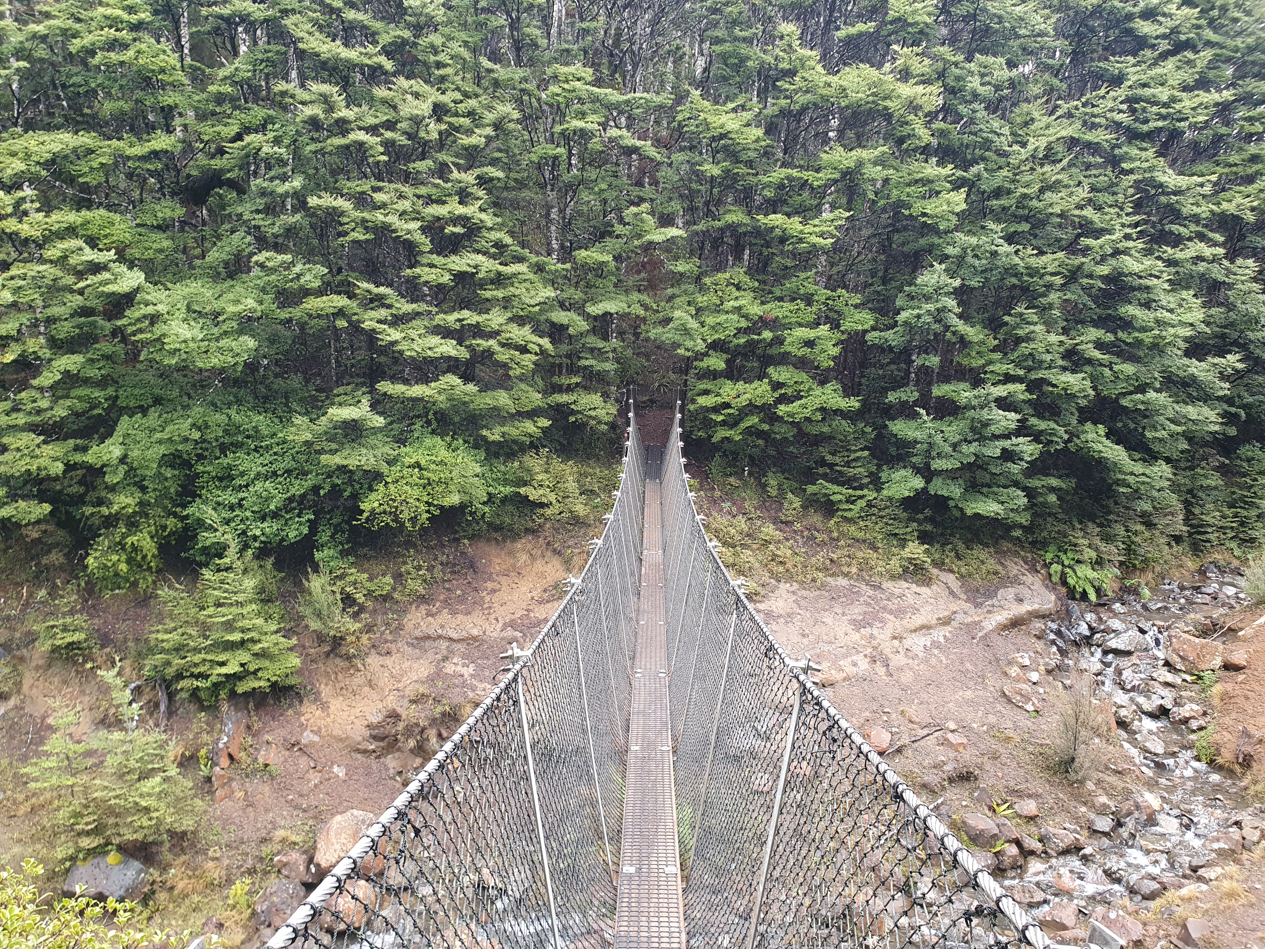
Sections of boardwalk cross the swampy parts of the track. The rain, although still light, had set in enough to motivate me to put on my jacket. Patches of mountain beech also provided shelter. A couple of major stream crossings are bridged, one by a old forest service style swing bridge.
Past about half way, tree cover becomes less frequent and travel is mostly above the bushline.
There are a few un-bridged stream crossings, none are particularly large or concerning but they tend be fast flowing with a few shin-deep patches (at least in this weather). To my relief, I managed to keep my feet dry though. Parts of the track were heavily eroded and there was quite a bit of surface water.
The hut is reached after about 7 km, which took me just over 2.5 hours. Mangaehuehu Hut is 1960s (?) lockwood structure, typical of Tongariro National park, with a layout not dissimilar to Oturere Hut.
In the first of what would become a series of good timings, the rain started falling heavily about 5 minutes after I arrived. An ample supply of firewood meant I had a roaring fire to keep me company while the frigid wind and rain swirled aggressively outside. In fact, later that night I suffered from the most bourgeoisie of tramping problems: getting too warm. But is there anything better than being in a cosy hut with a hot drink while the weather rages impotently outside?
The next morning the rain was still coming down heavily, although the forecast raised some hope of a let-up later in the morning. By 10am there was still a light but persistent drizzle but regardless I set off back toward the car park after giving the hut a quick clean, chopping some kindling and stacking a bit of wood inside.
In the next bit of luck, the rain stopped within half an hour of leaving the hut.
The sub-alpine landscape is stunning, the topography and flora refreshingly different to the Tararuas. The track is easy enough that the environment is easily enjoyed without the distraction of drawn-out uphill slogs and fat-guy exhaustion.
 |
Stream crossing below Waitonga Falls
|
It wasn't that long until I was back at the car park. A quicker tramp than I'd expected, but just the right level of challenge after a long period of not tramping. And I'll never complain about spending time in Tongariro National Park.
Map:
Distance: 6.94 km. Time: 2h33m in, 2h40m out.